Cooldorragha, Cúl Dorcha, "dark back or hill"


Location
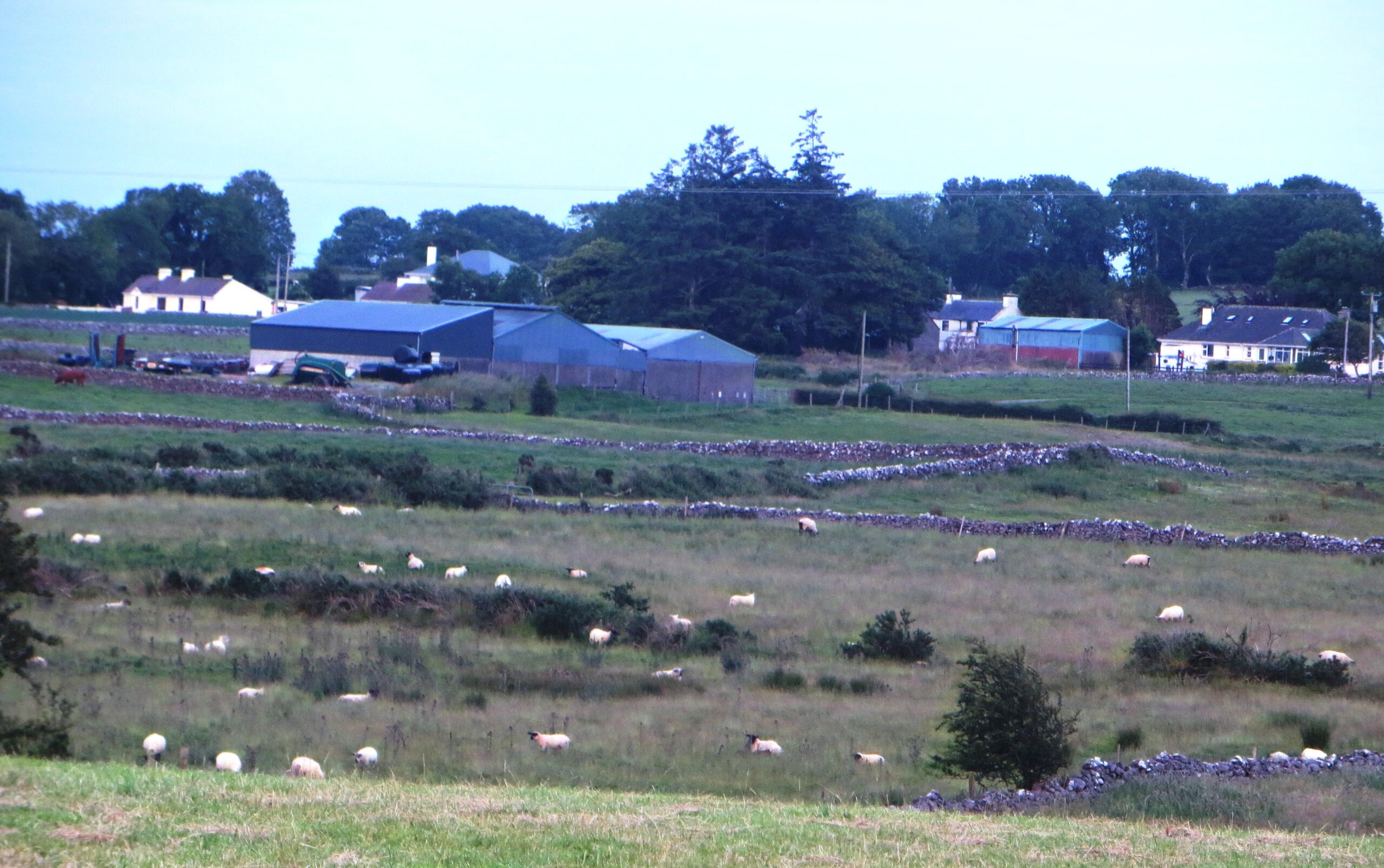
The townland of Cooldorragha is located in the east central part of the Parish of Killererin, in the Barony of Tiaquin. It is bordered by the Barony of Clare[2]. The Urban Survey Ireland[3] states that Barnaderg borders it on the west, Omaun Beg to the northwest, Omaun More to the north, Cottage to the east and Knock to the south.
O’Donovan’s Field Name Books
According to O’Donovan’s Field Names Books 1830, early references to ‘Carrowcouldorough’ were found in the Inquiries of James I (1603-1625) and to ‘Cooildoragh’ in the Inquiries of Charles I (1625-1649) and ‘Cooldurragha’ in the Map of Property Surveyed in 1813 and 1814.[1] The Boundary Survey Sketch Maps completed during the field names survey (which began in 1824) and officiated by John O’Donovan (1806-1861) and others, cited the spelling of the townland as Cooldurragha. [2] The townland is the property of H. R. Henry, Esq., England and contains 197¾ statute acres including about bog and rough pasture.[3] Today, locally the townland is spelled ‘Cooldorragha’.
Property of H.R. Henry
The townland is described as the property of H.R Henry of the Henry family of Toghermore. It contained 197¾ statute acres including about ⅓ of bog and rough pasture.[4]
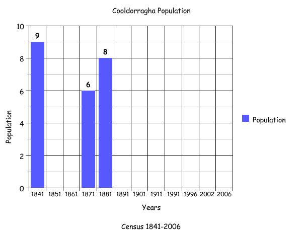
1841-1851 Census[5]
There were 9 people living in 1 house in the townland in 1841. By 1851 there were no residents living in Cooldorragha.
Griffith’s Valuation 1855[6]
There were 2 names listed as occupiers in 1855. They were Hugh Henry who retained 170 acres, 3 roods and 31 perches of land with an annual valuation of £25 0s 0d and Patrick Commons who leased 35 acres, 3 roods and 11 perches.
1861-1881 Census[7]
There were no residents listed as living in this townland in 1861. In 1871 there was 1 house with a population of 6 people. By 1881 there was 1 house with 5 out-offices and a population of 5 females and 3 males. It contained 198 acres with an annual valuation of £77 0s 0d.
1891 Census[8]
There were no houses or any people living in Cooldorragha in 1891
1901 Census[9]
There is no record of anyone living in this townland in 1901 according to the census information.
1911 Census[10]
There were no residents living in the townland in the 1911 census.
1926-1990 Census[11]
There is no statistical information on this townland until 1991.
1991-2006 Census[12]
There were no residents listed in this townland since the census of 1881-2006.
Mapping Changes[13]
The OS Maps (1837-1842) show Cooldorragha as a rectangular shaped townland. There was one dwelling visible on the map, located in the east of the townland close to the border with Cottage. There was no road leading to this house, so access would have been through the fields. To the northwest of the house a lime kiln and a gravel pit were situated.
A comparison between the OS 25inch map (1888-1913) and the modern 2005 Aerial Map showed how the landscape and geography has changed. In some cases however, the landscape has remained the same. The 1888-1913[14] maps show no dwellings or buildings in the area. The north and south of Cooldorragha were areas of bog and marsh. The modern map shows some farm buildings on site, 1 in the south reached by a small lane that leads to a road in the townland of Knock in the south. Much of the townland is farmland with some evidence of boggy ground at the southern point of Cooldorragha.
The accompanying graph shows the changes in population in this townland between 1841 and 2006 according to census information.
[1] Placenames Database of Ireland (www.loganim.ie) (Sep 2011)
[2] Galway County Library, O’Donovan Field Name Books’ (www.places.library.ie) (Sep2011)
[3] Urban Survey Ireland (www.osi.ie) (Sep 2011)
[4] Galway County Library, O’Donovan Field Name Books’ (www.places.galwaylibrary.ie) (Sep 2011)
[5] ‘Table V11- Area, Out-offices and Farm Steadings and Population together with the Valuation of Each Parish, Townland and Township of the County of Galway in 1881’ (James Hardiman Library, National University of Ireland, Galway, p56) (Sep 2011)
[6] Ask about Ireland, ‘Griffith’s Valuation’ (http://askaboutireland.ie/griffith-valuation/index) (Sep 2011)
[7] ‘Table V11-Area, Out-offices and Farm Steadings and Population together with the Valuation of Each Parish, Townland and Township of the County of Galway in 1881’ (James Hardiman Library, National University of Ireland, Galway, p56) (Sep 2011)
[8] Census of Ireland for the Year 1911[Province of Connaught, County of Galway] Area, Houses and Population, ‘Table VII-Area Houses Outbuildings-Buildings and Farm Steadings, and Population together with the Valuation of Each Poor Law Union, Dispensary District, Electoral Division, Townland in the County of Galway in 1911’ (Galway County Library, p110)
[9] The National Archives of Ireland, ‘Census Ireland 1901/1911’, (http://www.census.nationalarchives.ie/search/ (Sep 2011)
[10] ibid
[11] There is no statistical information in relation to this townland until 1991 (Sep 2011)
[12] Central Statistics Office, (www.cso.ie/census/reports) (Sep 2011)
[13] Ordnance Survey Ireland, (www.osi/publicviewer) (Jan 2012)
[14] ibid
No Comments
Add a comment about this page